

| |

")
")
")
| Name | West Sumatra Radar-Raingauge Integrated Data Version 1.1 |
| Abbreviation | WeSRI 1.1 |
| DOI | doi:10.20783/DIAS.37 |
| Metadata Identifier | WeSRI20230727051116-DIAS20221121113753-en |
| Name | Hideyuki Kamimera |
|---|---|
| Organization | Research Institute for Global Change, JAMSTEC |
| Address | c/o Research Institute for Global Change, Yokosuka Headquarters, JAMSTEC, Natsushima-cho 2-15, Yokosuka, Kanagawa, 237-0061, Japan |
| TEL | +81-46-867-9278 |
| FAX | +81-46-867-9255 |
| kamimera@jamstec.go.jp |
| Name | DIAS Office |
|---|---|
| Organization | Japan Agency for Marine-Earth Science and Technology |
| Address | 3173-25, Showa-Cho, Kanazawa-ku, Yokohama-shi, Kanagawa, 236-0001, Japan |
| dias-office@diasjp.net |
| Name | Hideyuki Kamimera |
|---|---|
| Organization | Research Institute for Global Change, JAMSTEC |
| kamimera@jamstec.go.jp |
| Name | Hideyuki Kamimera |
|---|---|
| Organization | Research Institute for Global Change, JAMSTEC |
| kamimera@jamstec.go.jp |
revision : 2008-08-02
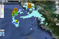
This is a gridded data set of precipitation over West Sumatra in Indonesia which is based on an integration technique of weather radar and ground-based raingauge data. We first derived an empirical relationship between radar and raingauge measurements. By using the relationship, we converted radar measurements into precipitation at each grid point. As pre-processing radar data, the effect of mountain shadow was taken account of. For evaluation of the effect, we developed a tool for analysing visibility of targets from radar using gridded terrain data. The effect of rain attenuation due to short wavelength of the radar was not considered.
climatologyMeteorologyAtmosphere
environment
| Begin Date | 2006-10-28 |
| End Date | 2006-11-27 |
| Temporal Characteristics | 30minute |
| North bound latitude | -0.05 |
| West bound longitude | 99.55 |
| Eastbound longitude | 101.05 |
| South bound latitude | -1.55 |
| Keyword Type | Keyword | Keyword thesaurus Name |
|---|---|---|
| place | Asia > South Eastern Asia > Indonesia | Country |
| theme | [Atmosphere |
GCMD_science |
| theme | ATMOSPHERIC PROCESSES > Precipitation, HYDROLOGY > Precipitation | AGU |
| theme | Water, Weather, Disasters | GEOSS |
| Keyword Type | Keyword | Keyword thesaurus Name |
|---|---|---|
| theme | DIAS > Data Integration and Analysis System | No_Dictionary |
You can find further details of WeSRI 1.1 at : http://www.jamstec.go.jp/e/medid/dias/kadai/mon/mon_rr.html
file download : https://data.diasjp.net/dl/storages/filelist/dataset:37
The creators of this dataset are not responsible for any loss or damage caused by using this dataset. The source should be properly acknowledged in any work obtained with this dataset, as follows."WeSRI 1.1 is based on observations from a weather radar in the HARIMAU (Hydrometeorological Array for ISV-Monsoon Automonitoring) project and a data integration technique developed in the DIAS (Data Integration and Analysis System) project, funded by the Ministry of Education, Culture, Sports, Science and Technology of Japan."
This data set should be referenced as follows."Hideyuki Kamimera, 2009: West Sumatra Radar-Raingauge Integrated Data Version 1.1 (WeSRI 1.1).Data Integration and Analysis System in Japan Agency for Marine-Earth Science and Technology, Yokohama, Japan."
If data provider does not have data policy, DIAS Terms of Service (https://diasjp.net/en/terms/) and DIAS Privacy Policy (https://diasjp.net/en/privacy/) apply.
If there is a conflict between DIAS Terms of Service and data provider's policy, the data provider's policy shall prevail.
If you plan to use this dataset for a conference presentation, paper, journal article, or report etc., please include acknowledgments referred to following examples. If the data provider describes examples of acknowledgments, include them as well.
" In this study, [Name of Dataset] provided by [Name of Data Provider] was utilized. This dataset was also collected and provided under the Data Integration and Analysis System (DIAS), which was developed and operated by a project supported by the Ministry of Education, Culture, Sports, Science and Technology. "