

| |
")
")
")
| Name | CEOP CAMP Mongolia Reference Site |
| Metadata Identifier | CEOP_CAMP_Mongolia20221122133813-DIAS20221121113753-en |
| Name | Ichirow kaihotsu |
|---|---|
| Organization | Department of Natural Environmental Sciences, Hiroshima University |
| Address | 1-7-1 Higashi-hiroshima, Hiroshima, 739-8521, Japan |
| TEL | +81-824-24-6497 |
| FAX | +81-824-24-0758 |
| kaihotu@hiroshima-u.ac.jp |
| Name | DIAS Office |
|---|---|
| Organization | Japan Agency for Marine-Earth Science and Technology |
| Address | 3173-25, Showa-Cho, Kanazawa-ku, Yokohama-shi, Kanagawa, 236-0001, Japan |
| dias-office@diasjp.net |
| Name | Ichirow kaihotsu |
|---|---|
| Organization | Department of Natural Environmental Sciences, Hiroshima University |
| kaihotu@hiroshima-u.ac.jp |
| Name | Ichirow kaihotsu |
|---|---|
| Organization | Department of Natural Environmental Sciences, Hiroshima University |
| kaihotu@hiroshima-u.ac.jp |
creation : 2010-05-06
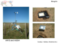
This data set contains the Coordinated Enhanced Observing Period (CEOP) Enhanced Observing Period 3 (EOP-3 and EOP-4) CEOP Asia-Australia Monsoon Project (CAMP) Mongolia 30 Minute Surface Meteorology and Radiation Data Set. This data set contains 30 minute data from the four stations in the CAMP reference site for the CEOP EOP-3 and EOP-4 time period, which are the BTS, DGS, DRS, and MGS stations. This dataset contains the entire EOP-3 and EOP-4 time period (i.e., 1 October 2002 through 31 December 2004).
climatologyMeteorologyAtmosphere
| Begin Date | 2002-10-01 00:00:00 |
| End Date | 2004-12-31 23:59:59 |
| Temporal Characteristics | 30minute |
| North bound latitude | 45.740000 |
| West bound longitude | 106.260000 |
| Eastbound longitude | 107.150000 |
| South bound latitude | 46.780000 |
| Keyword Type | Keyword | Keyword thesaurus Name |
|---|---|---|
| theme | Climate, Water | GEOSS |
| Keyword Type | Keyword | Keyword thesaurus Name |
|---|---|---|
| theme | DIAS > Data Integration and Analysis System | No_Dictionary |
: http://www.eol.ucar.edu/projects/ceop/dm/insitu/sites/ceop_ap/Mongolia/A3
: http://www.eol.ucar.edu/projects/ceop/dm/insitu/sites/ceop_ap/Mongolia/A6
: http://www.eol.ucar.edu/projects/ceop/dm/insitu/sites/ceop_ap/Mongolia/BTS
http://www.eol.ucar.edu/projects/ceop/dm/insitu/sites/ceop_ap/Mongolia/C2 :
http://www.eol.ucar.edu/projects/ceop/dm/insitu/sites/ceop_ap/Mongolia/C4 :
: http://www.eol.ucar.edu/projects/ceop/dm/insitu/sites/ceop_ap/Mongolia/D0
: http://www.eol.ucar.edu/projects/ceop/dm/insitu/sites/ceop_ap/Mongolia/D7
: http://www.eol.ucar.edu/projects/ceop/dm/insitu/sites/ceop_ap/Mongolia/DGS
: http://www.eol.ucar.edu/projects/ceop/dm/insitu/sites/ceop_ap/Mongolia/DRS
: http://www.eol.ucar.edu/projects/ceop/dm/insitu/sites/ceop_ap/Mongolia/E2
: http://www.eol.ucar.edu/projects/ceop/dm/insitu/sites/ceop_ap/Mongolia/E4
: http://www.eol.ucar.edu/projects/ceop/dm/insitu/sites/ceop_ap/Mongolia/F0
: http://www.eol.ucar.edu/projects/ceop/dm/insitu/sites/ceop_ap/Mongolia/G6
: http://www.eol.ucar.edu/projects/ceop/dm/insitu/sites/ceop_ap/Mongolia/GUS
: http://www.eol.ucar.edu/projects/ceop/dm/insitu/sites/ceop_ap/Mongolia/H7
: http://www.eol.ucar.edu/projects/ceop/dm/insitu/sites/ceop_ap/Mongolia/MGS
file download : https://data.diasjp.net/dl/storages/filelist/dataset:118
| name | version | specification |
|---|---|---|
| PRN | no information | CEOP Unified Format |
1. No financial implications are involved for the CEOP reference site data exchange.
2. Commercial use and exploitation of CEOP reference site data is prohibited.
3. Any re-export or transfer of the original data received from the CDA archive to a third party is prohibited.
4. The origin of CEOP reference site data being used for publication of scientific results must be acknowledged and referenced in the publication.
5. CEOP reference site data users are strongly encouraged to establish direct contact with data providers for complete interpretation and analysis of data for publication purposes.
6. Co-authorship of data users and CEOP reference site Principle Investigators on papers making extensive use of CEOP data is justifiable and highly recommended.
see http://www.eol.ucar.edu/projects/ceop/dm/documents/ceop_policy.html
If data provider does not have data policy, DIAS Terms of Service (https://diasjp.net/en/terms/) and DIAS Privacy Policy (https://diasjp.net/en/privacy/) apply.
If there is a conflict between DIAS Terms of Service and data provider's policy, the data provider's policy shall prevail.
A minimum requirement is to reference CEOP as:
The in-situ data is provided under the framework of the "Coordinated Energy and Water Cycle Observations Project (CEOP)."
for the Coordinated Energy and Water Cycle Observations Project data (2005), and as:
The satellite data is provided under the framework of the "Coordinated Enhanced Observing Period (CEOP)."
for the Coordinated Enhanced Observing Period data (2001 - 2004).
If you plan to use this dataset for a conference presentation, paper, journal article, or report etc., please include acknowledgments referred to following examples. If the data provider describes examples of acknowledgments, include them as well.
" In this study, [Name of Dataset] provided by [Name of Data Provider] was utilized. This dataset was also collected and provided under the Data Integration and Analysis System (DIAS), which was developed and operated by a project supported by the Ministry of Education, Culture, Sports, Science and Technology. "
Original data were collected and provided within the framework of JAXA-JRA "Ground Truth for Evaluation of Soil Moisture and Geophysical/Vegetation parameters Related to Ground Surface Conditions with AMSR and GLI in the Mongolian Plateau" (PI : Prof. I. Kaihotsu, Hiroshima Univ.). This JRA has been actually carrying out as an international cooperational project with Institute of Meteorology and Hydrology of National Agency for Meteorology, hydrology and Environment Monitoring of Mongolia.
Kaihotsu, I., Yamanaka, T., Oyunbaatar D., Ganbold, T., Davaa, G.,
and Koike, T., 2003: Long-term Monitoring by Water Cycle Stations in the
Central Part of the Mongolian Plateau. Proceed. 1st Inter. Conf.
APHW, 1, 117-120.
T. Koike, Y. Nakamura, I. Kaihotsu, G. Davaa, N. Matsuura, 2003:
AMSR-E Soil Moisture Product validated at the CEOP Mongolia Reference
Site. CEOP Newsletter, No.4, P5.