

| |
| Name | Spatio-Temporal Image Data Archive of 3.11 Earthquake and Tsunami Disasters and Recoveries |
| Edition | 1.0 |
| Abbreviation | 3.11 Image Archive |
| Metadata Identifier | TU_ImageArchive_311Tsunami_Disaster_and_Recovery20230727094220-DIAS20221121113753-en |
| Name | Koichiro Deguchi |
|---|---|
| Organization | Tohoku University |
| kodeg@fractal.is.tohoku.ac.jp |
| Name | DIAS Office |
|---|---|
| Organization | Japan Agency for Marine-Earth Science and Technology |
| Address | 3173-25, Showa-Cho, Kanazawa-ku, Yokohama-shi, Kanagawa, 236-0001, Japan |
| dias-office@diasjp.net |
| Name | Koichiro Deguchi |
|---|---|
| Organization | Tohoku University |
| kodeg@fractal.is.tohoku.ac.jp |
| Name | Koichiro Deguchi |
|---|---|
| Organization | Tohoku University |
| kodeg@fractal.is.tohoku.ac.jp |
publication : 2019-03-01
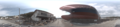
From April of 2011, we have been continuing to obtain video records of Tohoku coastal area Tsunami disasters of the 3.11 Great East Japan Earthquake for more than 6 years. We installed omni-directional cameras, Ladybug3 and Ladybug5, and GPS on a special car, and visited same disaster areas repeatedly at every one or two months. Along the Tohoku coastal area of total 500km length, we have recorded omni-directional high-resolution images at every 1 or 2m steps. The aim of his activity is to achieve a comprehensive spatio-temporal image data archive of 3.11 Earthquake and Tsunami Disasters and Recoveries.
imageryBaseMapsEarthCover
society
transportation
utilitiesCommunication
location
| Begin Date | 2011-04-18 |
| End Date | 2017-04-07 |
| Temporal Characteristics | almost monthly whenever it is necessary |
| North bound latitude | 40.546844 |
| West bound longitude | 140.763131 |
| Eastbound longitude | 142.069998 |
| South bound latitude | 37.769434 |
| Keyword Type | Keyword | Keyword thesaurus Name |
|---|---|---|
| theme | Disasters | GEOSS |
| theme | Maps/Charts/Photographs > STEREOGRAPHIC PHOTOGRAPHS | GCMD_platform |
| theme | Human Dimensions > Natural Hazards > Earthquakes, Human Dimensions > Natural Hazards > Tsunamis, Human Dimensions > Infrastructure > Buildings, Land Surface > Land Use/Land Cover > Land Cover, Spectral/Engineering > Platform Characteristics > Viewing Geometry, Spectral/Engineering > Platform Characteristics > Data Synchronization Time | GCMD_science |
| Keyword Type | Keyword | Keyword thesaurus Name |
|---|---|---|
| theme | DIAS > Data Integration and Analysis System | No_Dictionary |
At the above link site, the descriptions about the research project for this data is shown. The detail usages of the data is shown in the User-Manual page on this data-base. : http://www.vision.is.tohoku.ac.jp/jp/research/east_japan_earthquake_image_archive/
file download : https://data.diasjp.net/dl/storages/filelist/dataset:557
Please refer the User-Manual of this data-set.
| name | version | specification |
|---|---|---|
| PGR (Ladybug) Format | v.1.16 | Point Grey Research, Ladybug Data Format |
One scene image data is consisting of 6 images, 5 of holizontal azimuth images and one up-ward image. SDK(Software Development Kit) for Ladubug images to stich them into an 360 degree around image and handle it is provided by Point Grey Corp. only for non-commercial researches.
Use of the data is permitted freely, if the object is for the research purposes and without any change of the original data.
If data provider does not have data policy, DIAS Terms of Service (https://diasjp.net/en/terms/) and DIAS Privacy Policy (https://diasjp.net/en/privacy/) apply.
If there is a conflict between DIAS Terms of Service and data provider's policy, the data provider's policy shall prevail.
[Example of description in acknowledgements] The image data used in this research is composed by Deguchi and Okatani Lab. of Tohoku University, Japan, in their "Spatio-Temporal Image Data Archive of 3.11 Earthquake and Tsunami Disasters and Recoveries Project." We acknowledge the publication of this data and its permission of use for reserches by them.
If you plan to use this dataset for a conference presentation, paper, journal article, or report etc., please include acknowledgments referred to following examples. If the data provider describes examples of acknowledgments, include them as well.
" In this study, [Name of Dataset] provided by [Name of Data Provider] was utilized. This dataset was also collected and provided under the Data Integration and Analysis System (DIAS), which was developed and operated by a project supported by the Ministry of Education, Culture, Sports, Science and Technology. "
http://www.vision.is.tohoku.ac.jp/jp/research/4d_model/

")
")
")